
Friday, May 11th, 2018
Day 7: Road trip cont: Dingle to Doonbeg – On a quest for ruination…
Gales and heavy rain lasted all night, making for a rocky time in the van. The weather finally broke around 10 a.m., with only occasional morning showers. It kept improving throughout the day, turning into mostly sunshine with a biting cold wind—perfect weather for a lovely cruise in the van.
With so much to see and so many miles to cover today, I rocked Ireland to the sounds of Led Zeppelin’s Houses of the Holy and Physical Graffiti… tuuuunes!
My day started with breakfast on the dramatic Connor Pass, overlooking Brandon Peak and Brandon Bay. Brandon Mountain was looking handsome and broody this morning.
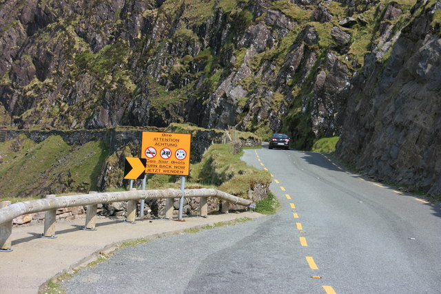
I continued on the slightly scary Connor Pass, “Kerry’s Most Scenic Mountain Drive”. As one of the highest mountain passes in Ireland (456 meters or 1,496 feet), the road features switchbacks, room for only one car in places, waterfalls onto the road, and sheer drops to the left.
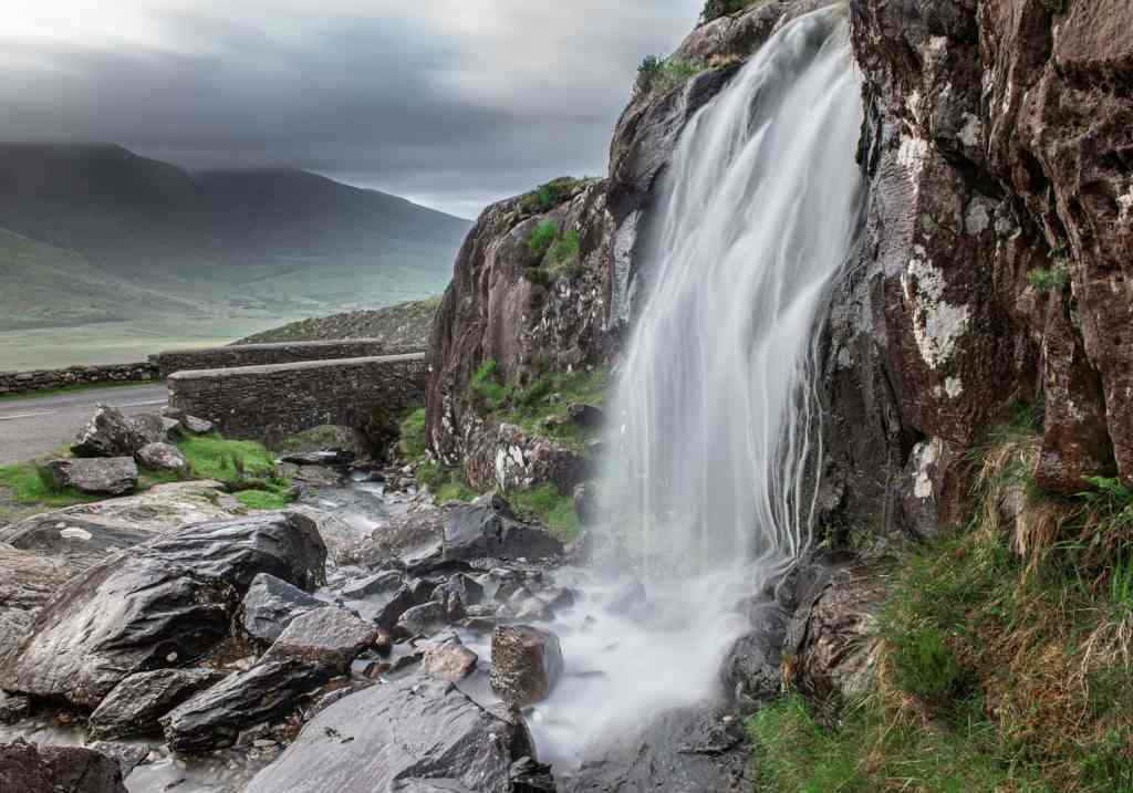
It is a tight, twisting route that links Dingle with Brandon Bay and Castle Gregory, and vehicles over two tonnes are prohibited because the road’s so narrow. I felt like one of the ice road truckers, but the views were spectacular.
Heading down towards Castle Gregory Beach and Tralee Bay, the scenery mellowed into gentler landscapes of meadows, marshland, and long sandy beaches against the backdrop of the Stradbally and the Slieve Mish Mountains. It was altogether different from the dramatic landscapes of previous days, but no less beautiful.
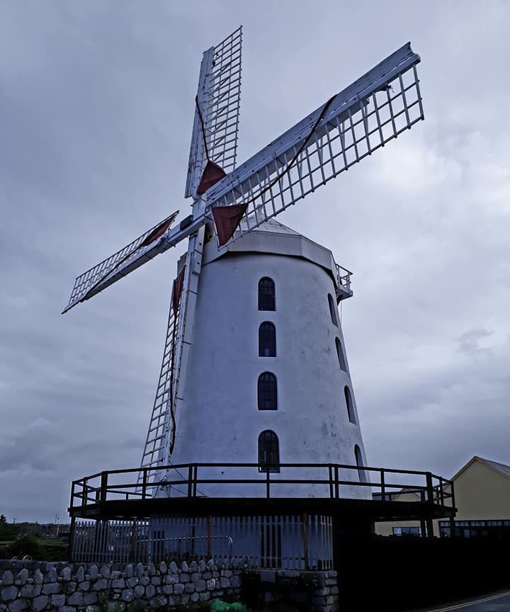
I passed through Tralee and Fenit and paused to look around the historic sites: Blenerville Windmill, Tralee, and Fenit Harbour.
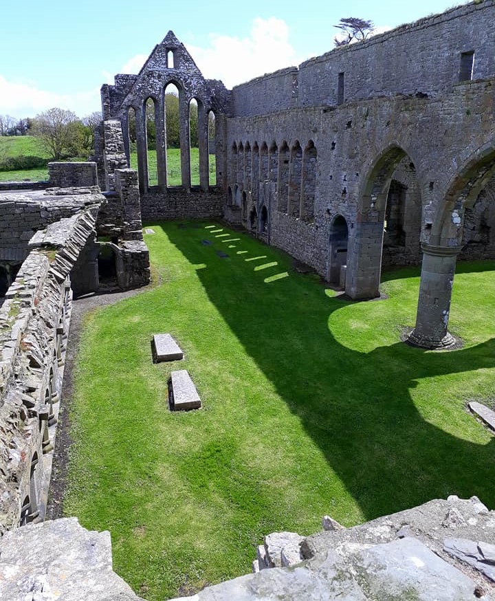
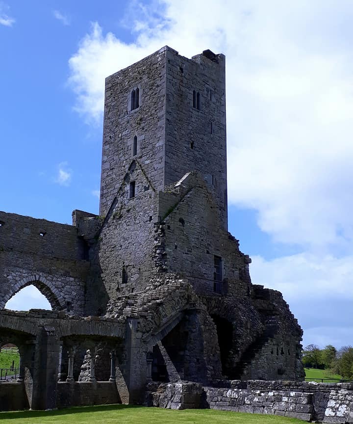
· Ardfert Cathedral and Monastery
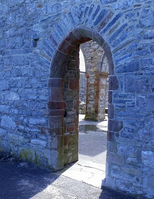
The red sandstone Arches have been lovingly restored to stop the structure from collapsing. The colours in the stones were incredible.
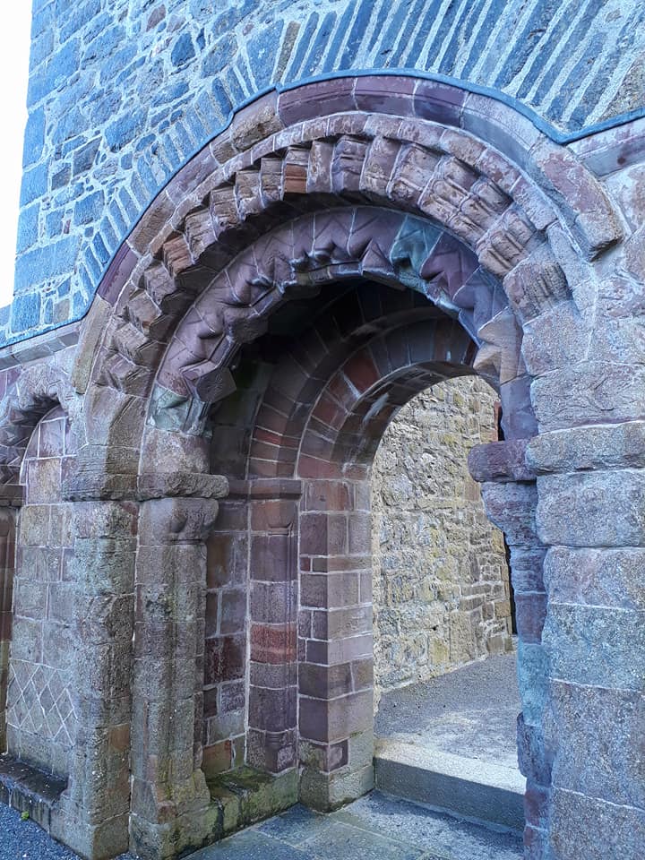
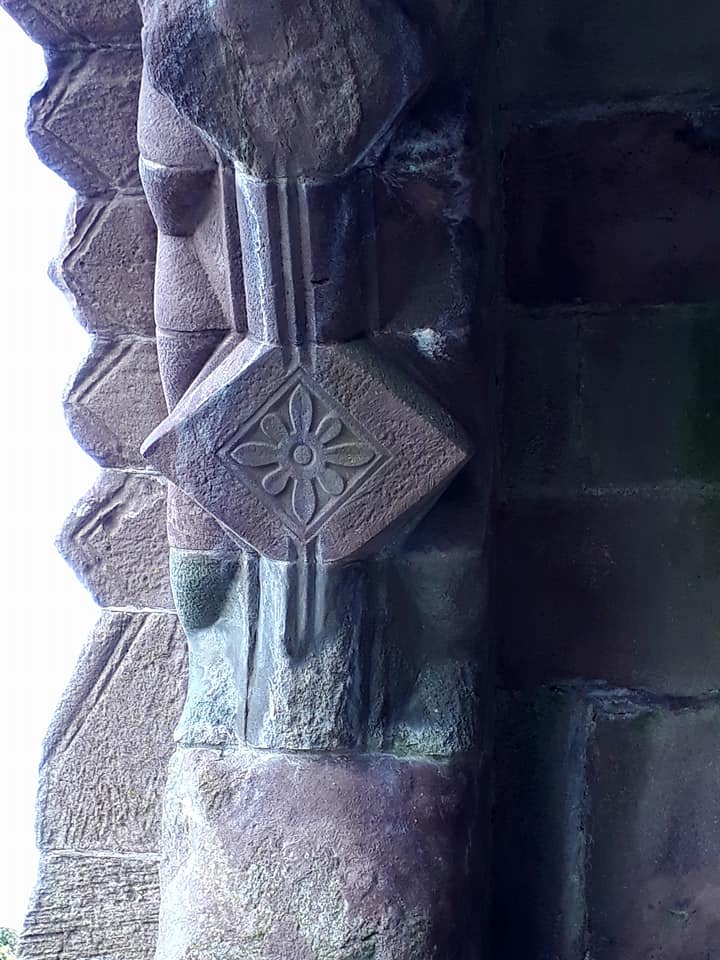
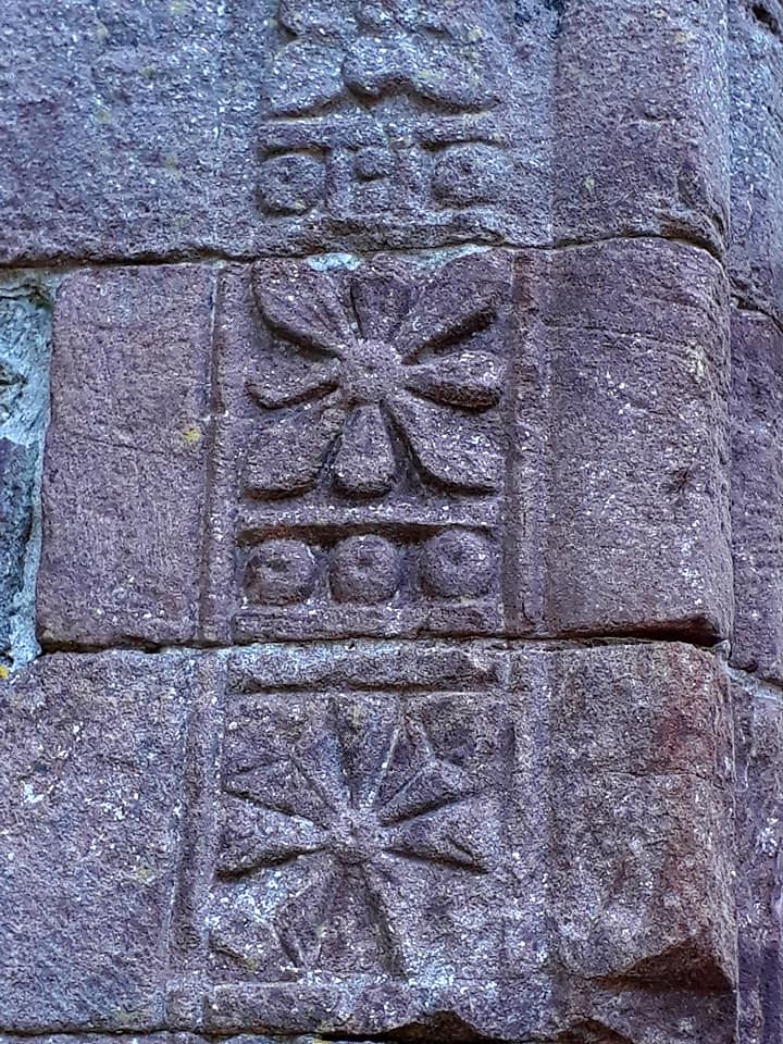
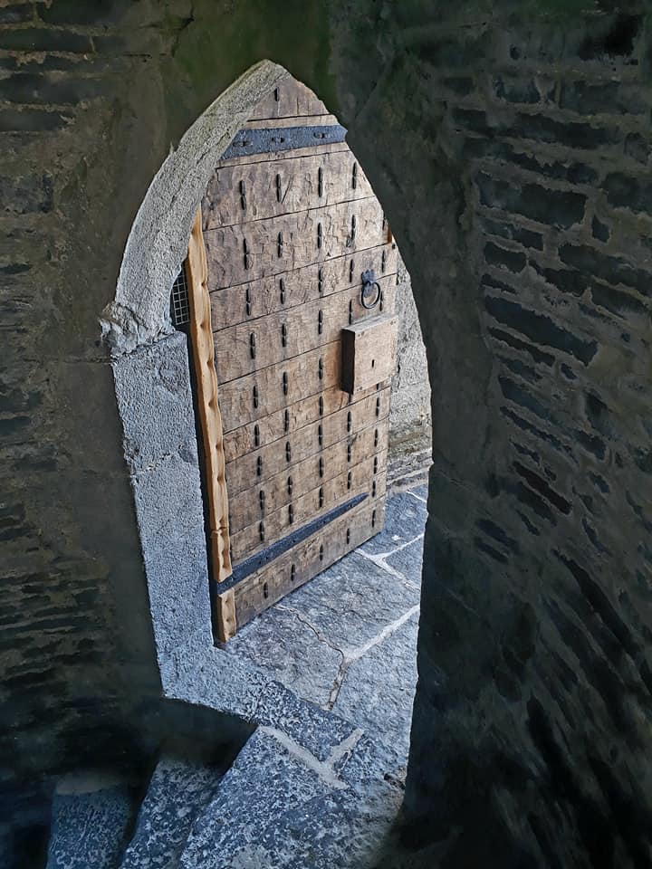
Beautiful doors
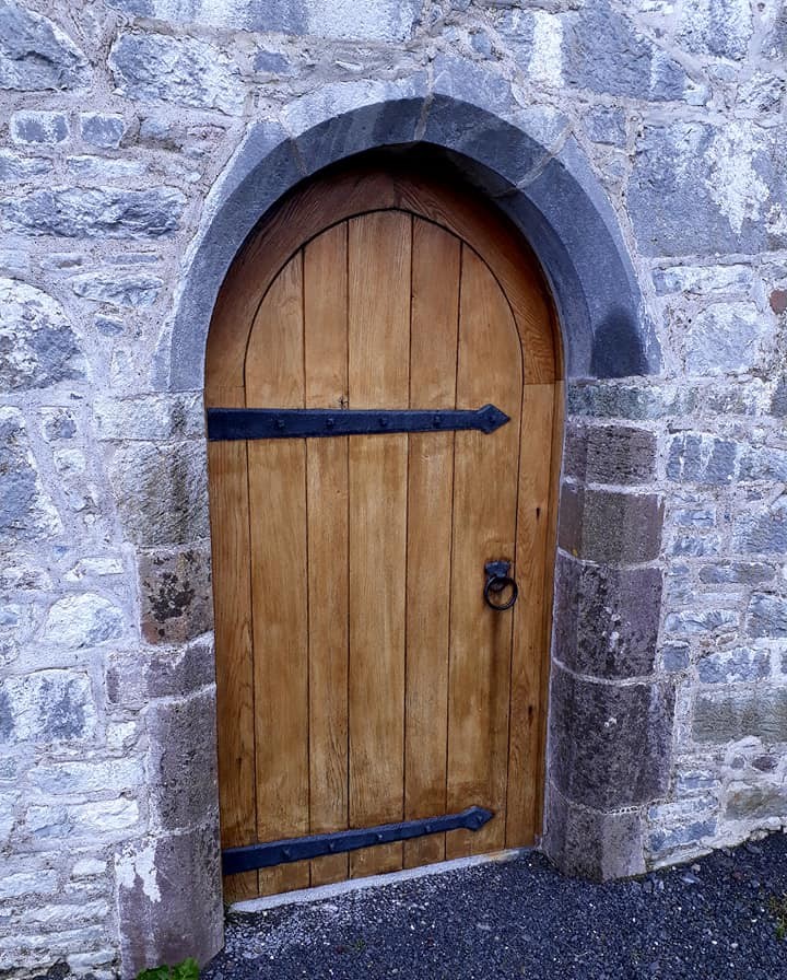
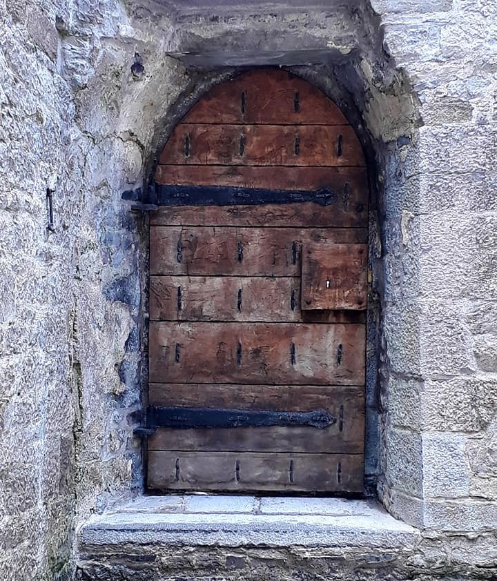
Grave cover stone
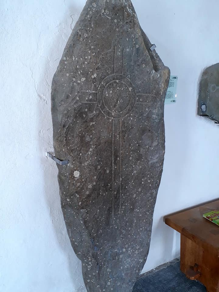
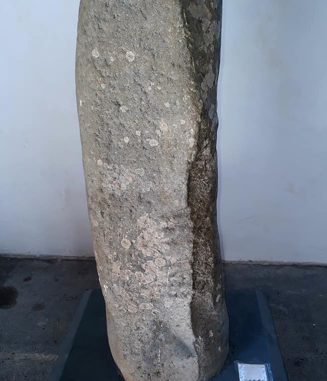
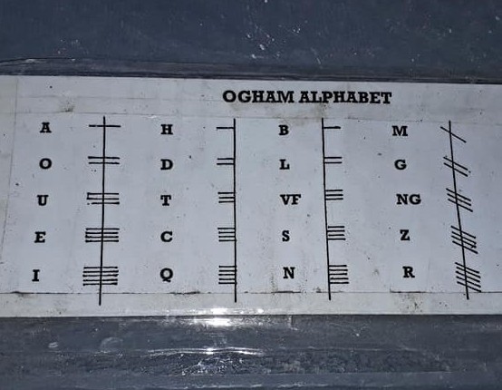
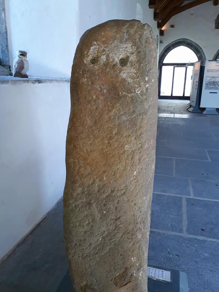
Ogham stone with Alphabet … you can now work out what it says.
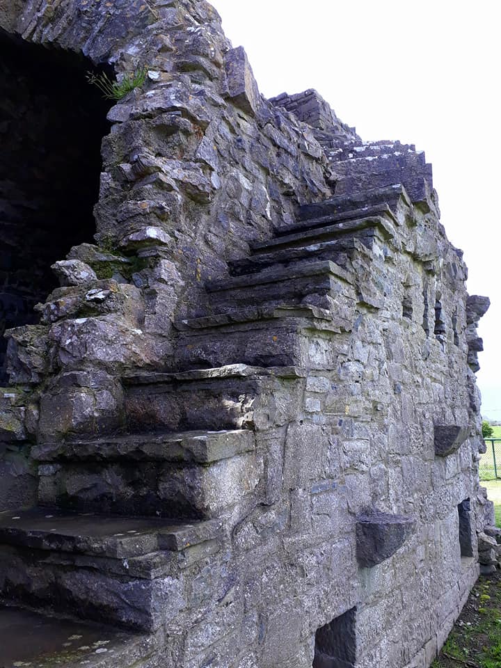
Stairs are meant to be climbed.
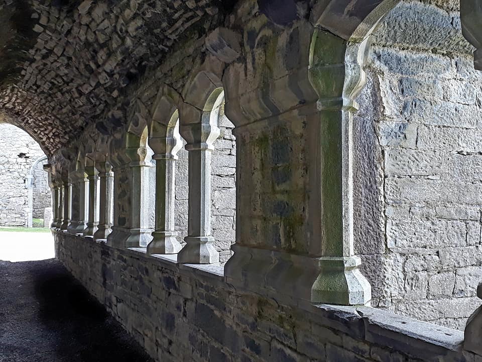
I do love a good cloister.
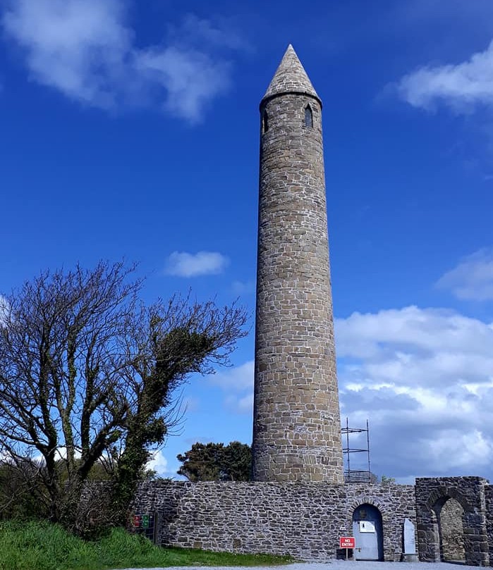
· Rattoo Roundhouse at Ballyduff
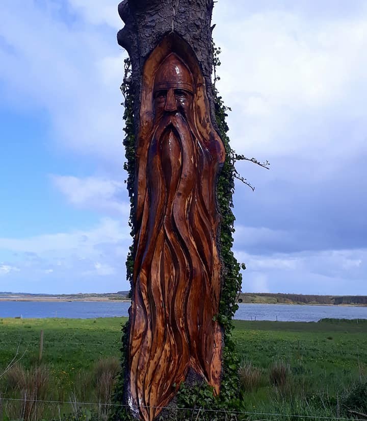
Carving on route to Carrigafoyle Castle
The highlight of my day was discovering Carrigafoyle Castle. It sits right on the edge of Ballylongford Bay, with views across the River Shannon. The castle was originally built around the 1490s and, due to its strategic position controlling the shipping lanes, was known as the ‘Guardian of the Shannon’.
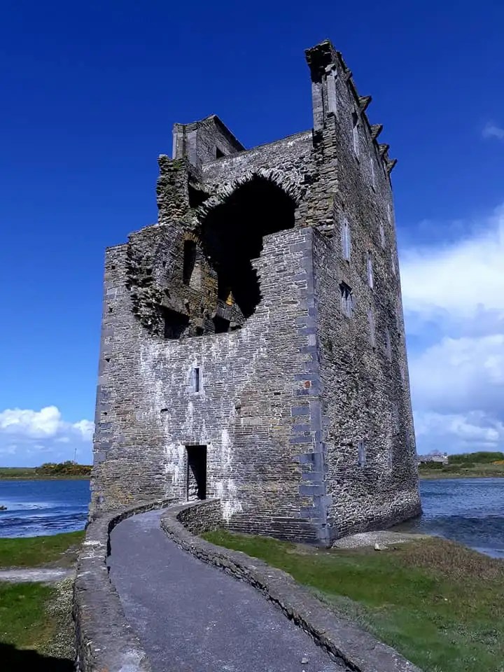
I found the setting so picturesque that I could have sat there for hours, and the castle itself is a “little gem.” This five-story tower house, once set on a rocky outcrop and featuring a fortified harbour for boats, is one of the finest examples of 15th-century Irish architecture. It had a dramatic history, including the Siege of 1580.
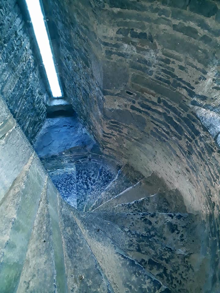
Partly restored, you can climb the stairs to the top of the tower and explore all the rooms. It is such a magical place, now in the possession of nesting Swifts and Jackdaws. The former were flying with precision from room to room above my head, just lovely.
Then a brief visit to Lislaughtir Abbey, now home to a strange mix of ancient and new headstones, with barely room to move. It is impossible to walk around without stepping on a grave. It is a curious thing that people still bury their loved ones in the ruins of ancient abbeys.
The Abbey, properly known as Lislaughtin Franciscan Friary, was founded in 1470 by the same influential family who controlled the area, the O’Connor Kerry clan, specifically John O’Connor. It was built on the site of an earlier church and became one of Kerry’s most important religious institutions.
The Friary, renowned for its elegant Hiberno-Gothic architecture, met a violent end in 1580 when English forces sacked it after the Siege of Carrigafoyle Castle. Despite being destroyed, the site’s enduring sanctity meant the church and graveyard remained in use by the local Catholic population, continuing its long tradition as a sacred final resting place. That explains the cramped conditions.
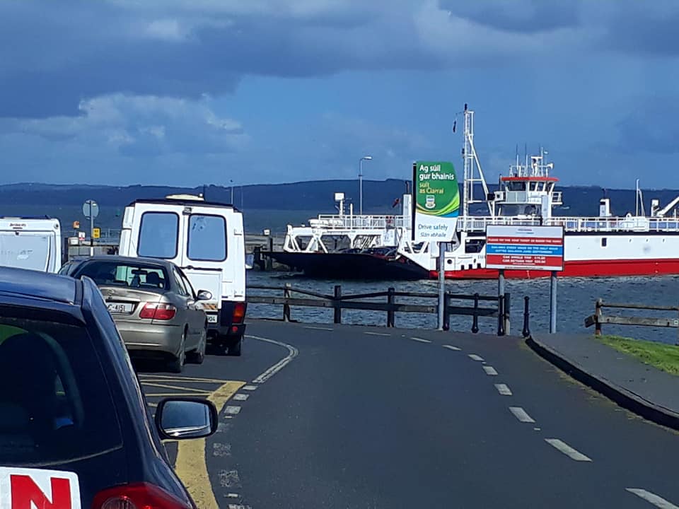
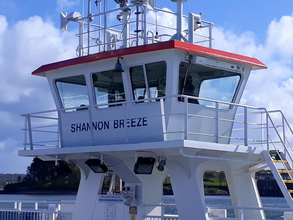
The final leg of my journey was an exciting 20 min crossing on the Shannon Ferry across the Shannon Estuary to leave the Kingdom of Kerry behind and on to the iconic County of Clare. This is a place which my feet have trodden before … ahh, so wonderful to be back.
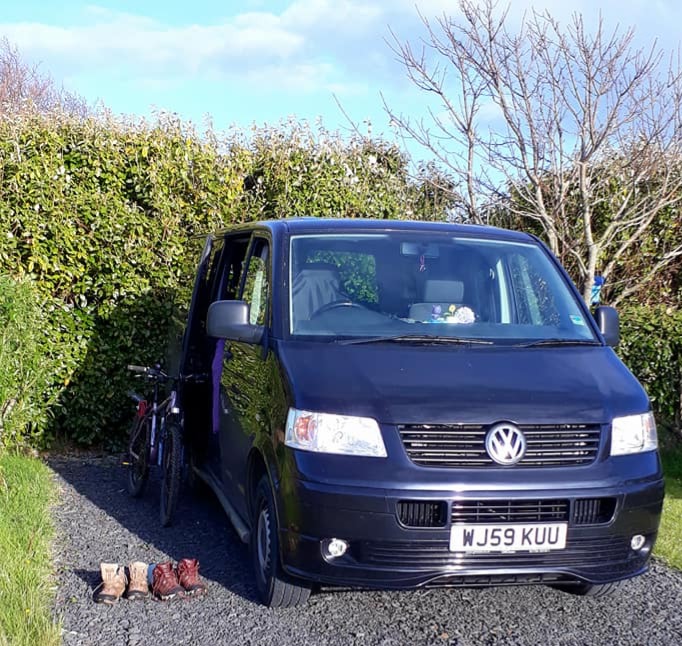
After an exciting but long and tiring day, I found a place to haul up for the night, Strand Camping in Doonbeg. This is a lovely, quiet campsite, where I had the best shower, grooving to music. Yes, they play music in the toilet blocks. It was also a great opportunity to tackle much-needed, overdue camp chores: the laundry, cleaning the van, and replenishing supplies. Everything is now clean and smelling lovely.
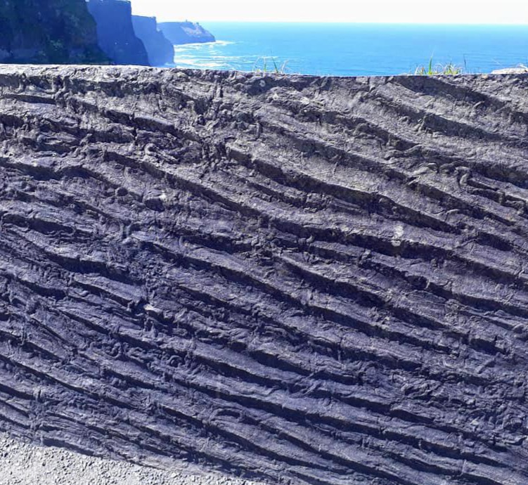
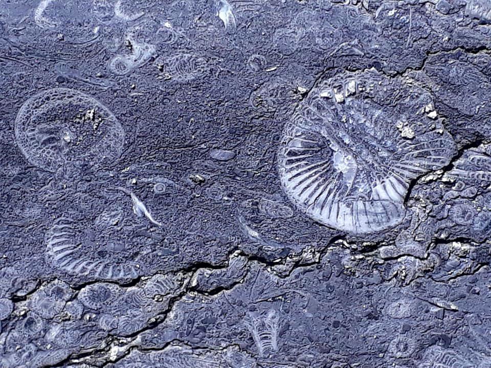
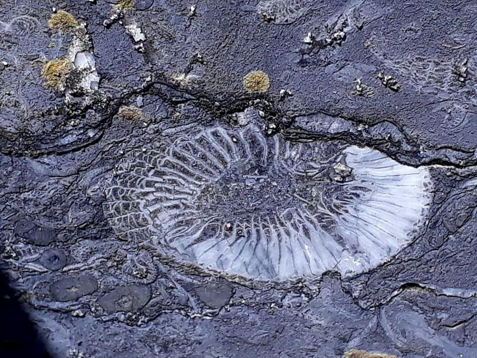
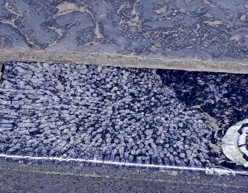
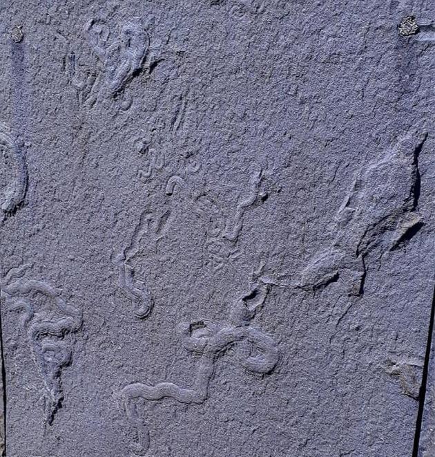
Tomorrow I will have another tourist day on my favourite Cliffs of Moher and Doolin. The last few days have all been about ice-age sculpted mountains. Now we move on to fossils, fossils, fossils everywhere. I recall being here years ago, and finding them in abundance—even embedded in the pavements. I couldn’t take my eyes off the ground; it was so exciting.
Saturday, May 12th, 2018
Day 8: Road trip continues … Doonbeg to New Quay lol
After a cold night, I had a leisurely morning, a lie-in, a bacon butty, and coffee. Then back on the road at 10ish. I took my time just cruising through gently undulating country roads, mostly past beaches (Strands), wetlands, and fields
I passed Trump’s Golf course, gahh.
I spotted a sign for a coastal walk along the Cliffs of Moher, a few miles before the main tourist spot. It was a car park on private land, €2 for the day, a bargain. The locals are very enterprising and make the most of tourism where they can.
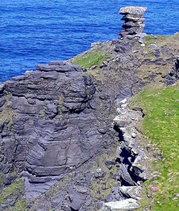
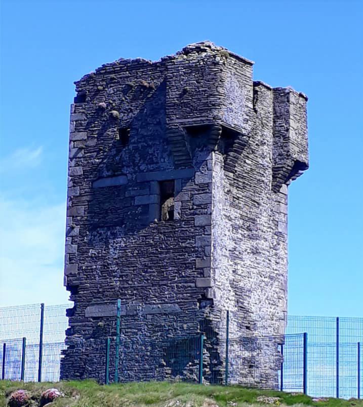
There were a few other intrepid walkers on the coast path; otherwise, it was peaceful … Well, for a while anyway. The sun was shining, skylarks sang above, and there was a cool breeze behind me, perfect.
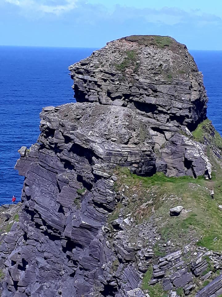
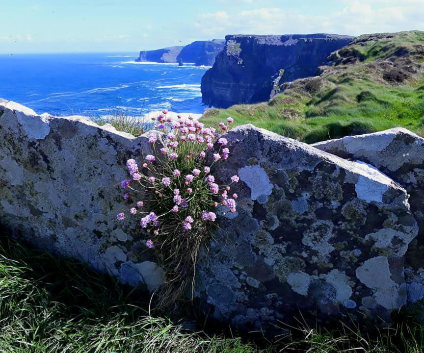
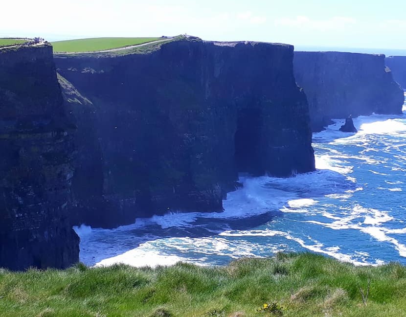
I last visited the Cliffs of Moher in the 90s and only went to the tourist end, so it was lovely to return and walk the length of the cliffs. It is quite spectacular, with giant sandstone cliffs and deep turquoise seas below. Fulmars and choughs populate the ledges.
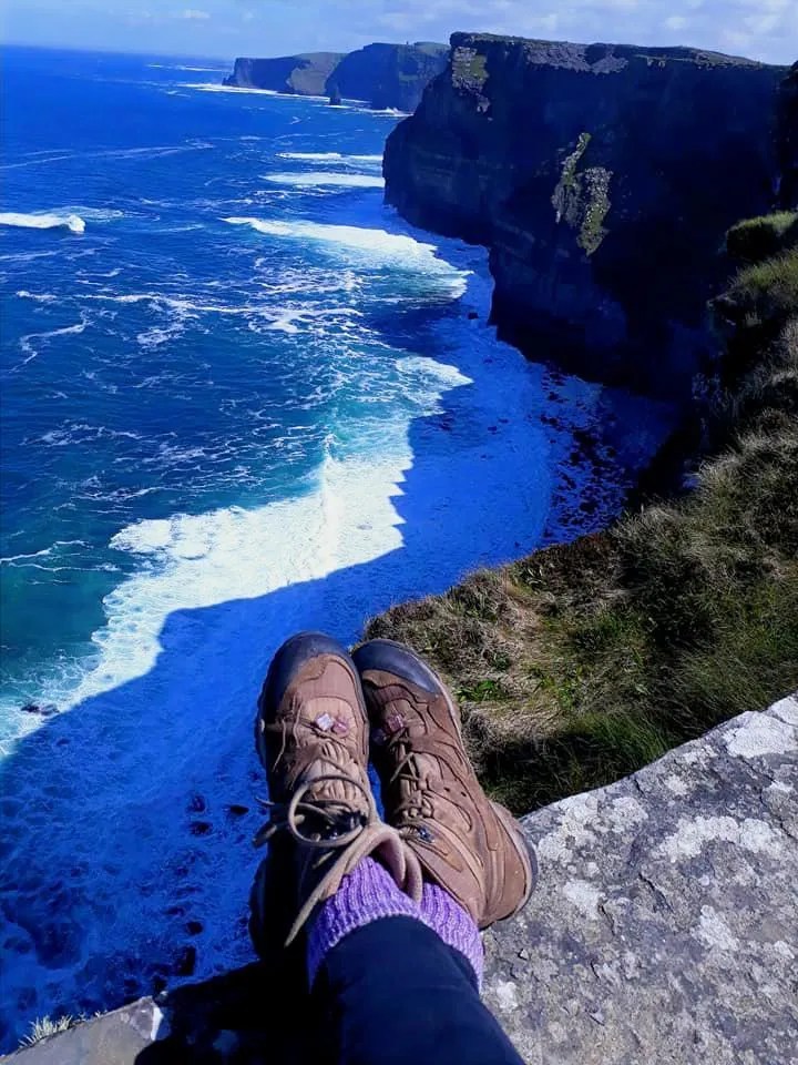
Pausing for a while on the cliff edge, a Fulmar flew past, looked me straight in the eye, then carried on.
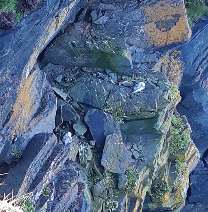
Fulmars nesting …. I love these dumpy little Albatrosses.
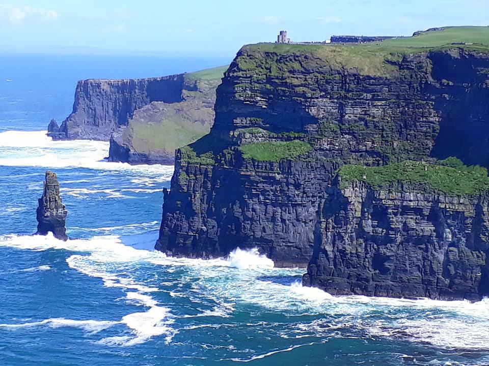
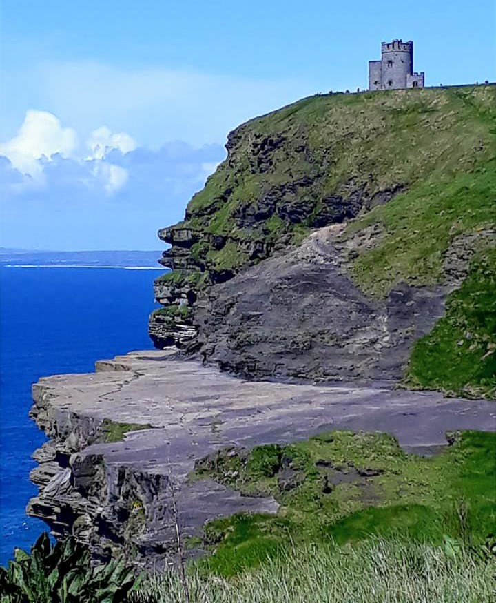
Cliffs of Moher and views of O’Brien’s Tower, built on the cliffs in 1835 by the local landlord and MP Sir Cornelius O’Brien as an observation point for the English tourists who frequented the area at the time. Now a craft shop and visitor centre
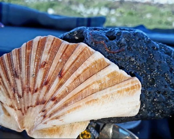
My burrrn rock … and half a Camino shell … very apt .. as it’s only half done
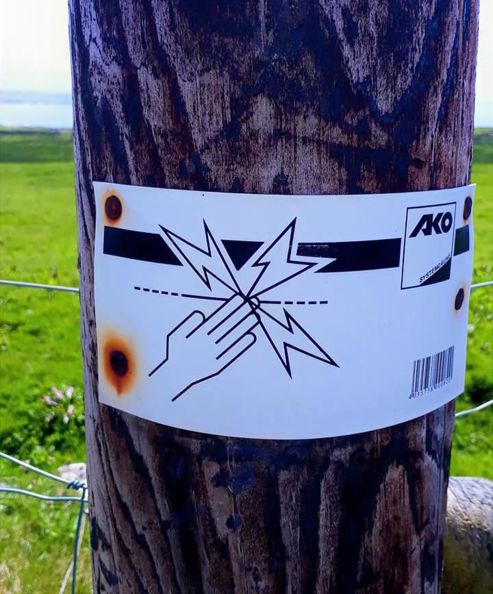
After about 3 ½ miles, I arrived in tourist hell, peace shattered. Coach loads of tourists, all wandering mindlessly about like a zombie nation. Looking down at their phones, or jostling to take selfies, all standing way too close to the edge of the cliffs. I pondered whether the Cliffs of Moher were the top destination for achieving a Darwin Award. My only secret joy at this point was when the occasional hapless tourist got zapped by the electric fence …
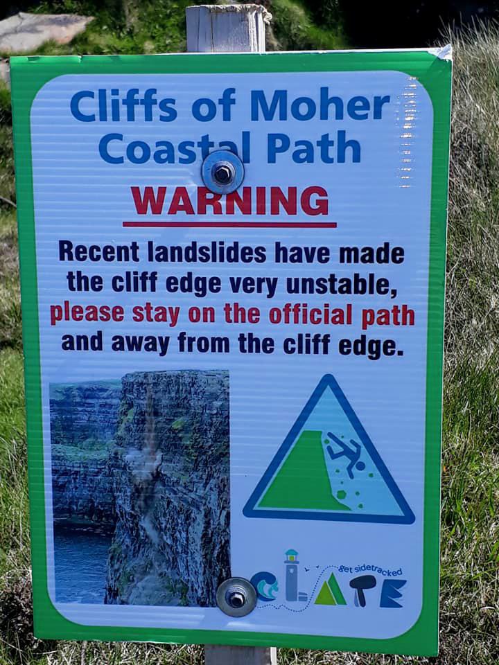
I stayed long enough to view the fossils; most tourists were unaware of the marvels beneath their feet before heading for my beloved Doolin.
Such fond memories of Doolin and the Burren, the latter being so amazing and vast that my road map has a whole page of its own dedicated to it.
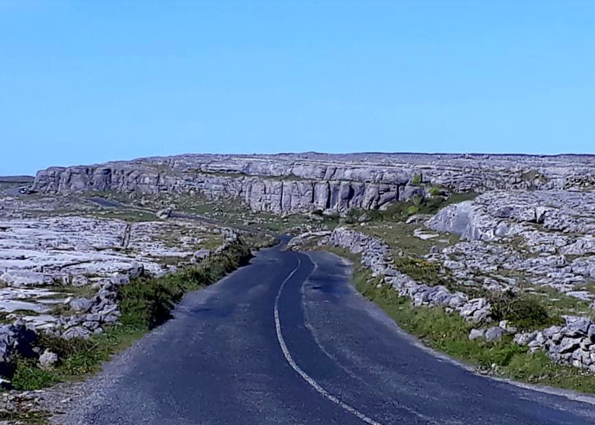
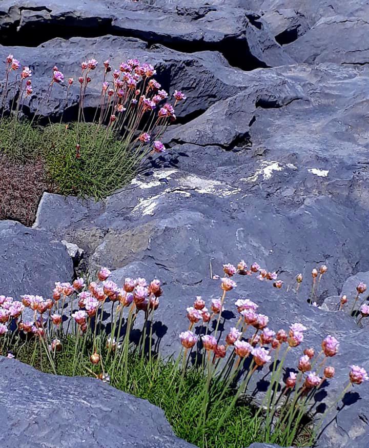
There was barely anything here the last time I visited, just a high street, three pubs, and the harbour. Of course, tourism had taken hold, and now there are shops, houses, visitor centres, etc.; it saddened me…
The lovely hostel I stayed at many years ago, on the river and nestled quietly in its beautiful surroundings, is now crowded with buildings.
I stopped off at the quay to watch the ferry going out to ‘Craggy Island’. Nothing changes here. I remembered having to leap aboard the ferry in rough seas … crazy. The sea and the Burren are still spectacular.
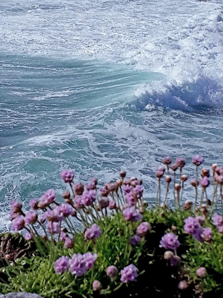
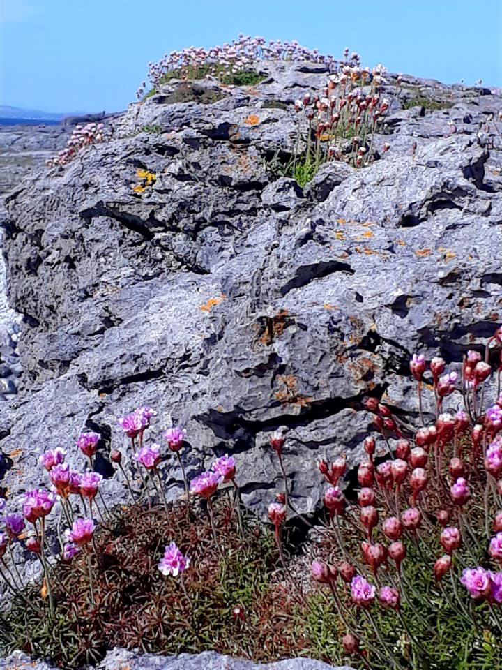
The Burren is vast, stretching for miles, from the beaches, up into the mountains, and is somewhat reminiscent of a lunar landscape. Don’t walk it in the dark … you will break an ankle.
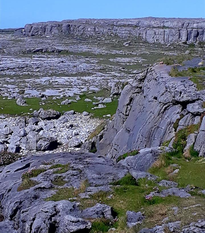
On my way out of Doolin, I drove past McGann’s pub and had a sudden flashback to many wonderful nights in there, watching musicians, drinking Guinness, and chatting with the locals.
I found a place to haul up for the night in New Quay, at a small parking area by a beach, and set about cooking up some much-needed sustenance. Tomorrow I head for Galway, avoiding Ed Sheeran! I spent the evening pondering how I can complete my two final walks, if at all … so near yet so far.
Sunday, May 13th, 2018
Day 9: More road tripping New Quay to Murrisk via Ballintubber Abbey
My day started to the sound of cars drawing up alongside me. Car doors being slammed, excited chatter. It was the Sunday swimmers all turning up for a chilly dip at 9am. I thought about joining them for 10 secs. Them in their bathing suits … me in a rash vest plus a wetsuit….
I felt grumpy all day; costs have thwarted my plans, and it was all starting to feel like a hindrance rather than an event. After a long day driving, I am now sat beneath Croagh Patrick in County Mayo, and even that didn’t raise a smile.
Do I really need to walk all 5 Pilgrim Trails, especially considering the cost? This is the question that has been plaguing me all day: what are you doing this for? Certainly doesn’t feel enjoyable today.
There are no other Pilgrims around to share the journey and experiences with. It will cost €10 to register to walk Tochar Phadraig tomorrow, if I decide to, and another €45 in taxi fees to get to the start point.
This would not happen on the Spanish Camino … I feel the magic has gone … I’ve lost my Camino mojo.
I left New Quay this morning, tired and reluctant to leave. I half wish that I had stayed in Doolin or further down the coast; I preferred the landscape down there, and was less than inspired by the scenery today.
I passed by Dunguaire Castle, pretty, but even that didn’t inspire me, and it was €8 to view. So I headed to Galway, after being Pixie led by signs for scenic views. Flaggy Shore and Tráigh Beach were both really pretty.
Then the roads became more ordinary and suburban as I got closer to Galway. No sign of Ed … but so much traffic. It was quite a shock after the empty roads of previous days. I stayed long enough to get fresh provisions and drop into Halfords. I hoped they could fix the flat tyre on my bike, then I could split the walks up, two days each. And cycle the shorter distances to my start points. But alas, they were too busy.
I drove onward along the Silver Strand, packed with vehicles and Sunday drivers. I continued all along the coast and got Pixie led some more. After a while, this became so time-consuming and exhausting that I had to be firm with myself about the time-consuming main WAW route….. You can’t see everything.
The Galway and Mayo stretch of the WAW is, of course, pretty. But if you stayed on the WAW for the whole of this stretch, it would take a couple of very patient days.
The landscape changed little. Patchworks of fields filled with grassy tussocks and Burrenesque rocks, lined with stone walls. Inlet after inlet after inlet … in and out, up and down on the bendiest and undulating roads. It has taken me all day to get this far, and I left the WAW for a more direct route around 4pm.
I’m tired, and all road-tripped out; I just want to rest in a pretty place and do nothing, even listening to The Doors didn’t cheer me up.
I dropped into Ballintubber Abbey, Murrisk, to speak with someone about the walk… hoping that might help me make a final decision. Nobody was there, and I’ve got no response to my posts for walking buddies. I drove here thinking that would help with my indecision… it did not.
So there I sat … waiting for inspiration, a sign, something … I had never known such indecision.
But alas … this Pilgrim trail has ended, I think…
May 14th
Day 10: A Day in Connemara
Yesterday was an odd day; I felt tired and disenchanted. Driving on endless bendy and unruly roads with few places to stop and even fewer vistas to enjoy.
I was still driving around at about 10pm last night, trying to find a place to park up. The WAW signs led me astray to Carrowinsky and ‘The Lost Valley’ both strands. The track to the former led straight onto a shale beach. The beast was not happy with that. And although both beaches would have been lovely during the day … at night they were very isolated, no other campers were there, and it was a tad spooky even for me.
So outside the cemetery in Killen had to do
I awoke much refreshed in the morning and headed back towards Clifden. I was staring at my fuel gauge, cursing my indecision last night; 1/4 tank wasted driving to a Pilgrim Path I didn’t do.
Still, hindsight is an amazing thing … and if I hadn’t done that, I wouldn’t have seen all the lovely things I saw today. Sometimes you have to lose yourself to find yourself again …
I happened upon Kylemore Abbey & Victorian Walled Gardens where I enjoyed breakfast. Kylemore Abbey is a Benedictine monastery founded in 1920 on the grounds of Kylemore Castle, in Connemara. The Abbey was founded for Benedictine Nuns who fled Belgium in World War 1. I walked their woodland trail and the Victorian gardens; it was so lovely and peaceful … just me and the birds. I also made time for a bit of cakey tea later in the day.
I continued my journey and paused at Connemara National Park to climb a very delightful large hill. The views from its summit were most impressive. There were quite a few other walkers; it was nice to have human contact and conversation. The weather was overcast with sunshine, lol; either way, I was in a T-shirt. It was quite humid and yet also refreshing up high. I stopped for lunch at the visitor centre after surviving on van food for so long; I was so ravenous I nearly continued up my own arm.
On then to Clifden via the Sky Road; it didn’t disappoint, with beautiful views and so many places to stop and enjoy them … I felt my mojo returning. Finally I arrived in Clifden around 5pm and stumbled across a bike shop that fixed Claud on the spot. He may now be of some use instead of just cluttering up the van.
I’m now parked up at Derrigimlagh Bog … what I hear you say. It is a place of great historical significance. John Alcock and Arthur Whitten Brown were the first pilots to fly nonstop across the Atlantic. They crash-landed here, safely, in the bog. It also has the remains of Marconi’s first transatlantic radio station … yes, the sister station of Porthcurno.
There is a loop walk here which I can explore in the morning. But now I need to decide what to do. My time in Ireland is coming to a close. At some point I have to head inland towards Wexford and onto Rosslare on Friday.
With the bike fixed, St Kevin’s Way may be possible…..
But where to go next … I’m loath to leave the coast; it’s so beautiful. Perhaps go back to Doolin for a day? Or are there any nice places to visit en route to Wexford?
May 15th
Day 11: Reluctantly leaving the Wild Atlantic Way
I awoke to mizzle and set off early for what would be my final walk on this beautiful coast.
The Marconi Loop was a fascinating walk through time, a historically significant trail. Derrigimlagh bog is also the site of the Marconi Station and Alcock and Brown’s landing site.
The trail winds its way through the bog, which is still being worked for peat today. It is a wild place at the best of times, but also peaceful and very atmospheric today in the mist and mizzle. There was nothing here but myself, bleating Jacob sheep, the ever-present skylarks, a solitary cuckoo, and the odd Irish Hare scurrying about.
It was a fascinating place, well thought out with information plaques and photographs that lead you through time and Marconi’s work.
By the time I got back to the van an hour and a half later, I was soaked. So there was no delaying, well actually there was … I headed off slowly south, back down the WAW. There was a faster route, of course, but I was in no hurry to leave … I am the worst at saying goodbye.
I wound my way back down to Galway via Ballyconneely, Dogs Bay – Port na Feadoige, past impossibly pretty inlets, pausing here and there and just about everywhere to capture them in photographs. I stopped for breakfast in Rounstone, then reluctantly wrenched myself off the WAW back onto the N59, along the edge of Connemara National Park, the Twelve Bens, and the Maumturks. Then, in Galway, I took the M6 and M18, Ireland’s version of motorways/dual carriageways.
So big, so new, so green, so smooooth and so empty … but a pleasure to drive after the bone-shaking potholes of Ireland’s minor roads…
My original plan was to split the journey east into two days. I paused, halfway to fuel myself and the beast and filled her battered tyres with air. Then I made the most of the poor weather and headed straight for Glendalough/Hollywood, the start of walk No 5.
I’m now camped about 15 mins from the latter and St Kevin’s Way. Loona, my host, was very helpful and acquainted me with the area. We pondered the logistics of me getting to my start point and back. She is convinced I will find someone to take me ‘across the gap’ tomorrow. Otherwise, quotes for taxis … €50
She is also a frickin genius: “you can always walk halfway then walk back”. Goddammit, why didn’t I think of that??? But then that would be 2 days with 20 miles/day rather than just one day. But I have a cunning plan … if I start from Valley Mount instead of Hollywood; this is only 9 km to Ballinagee Bridge to get there and back, then I can do the other half Thursday, either by getting a lift from Glendalough back to Ballinagee, or a taxi; either way, the cost is greatly reduced.
The route from Valleymount is also supposed to be nicer … it’s a plan
May 16th
Day 12: St Kevin’s Way Pilgrim Path No 5
Miles: Approx. 15
I awoke to a beautiful sunny day after a cold night. My plan was to walk part of St Kevin’s Way and walk back… then return and complete the rest tomorrow…
I decided to walk from Valleymount rather than Hollywood. It was shorter for a start and possibly less expensive by taxi. Also in John G O’Dower’s book, he described the route from Hollywood as “disappointing, with seemingly interminable by road.”
That didn’t sound very inviting, so I drove to Valleymount, parked the beast for the day, and set off from the church around 9.30am. I picked up the first marker just after the church and before the pub, which pointed me along the main road out of the village.
The next marker is on the right-hand side of the road opposite the turning for Ballyknokan and an information board about St Kevin. The marker points straight ahead; however, the road forks. The main road continues to the right, and a by road turns left. There is no marker … anywhere to indicate the direction of the route… my map says left.
I continue left down the quiet lane, with fields of sheep and farmhouses here and there, which then gives way to plantations. Farmhouses for some time, then a marker. Feeling relaxed, now that I know I’m on the right track, I begin to enjoy my morning. The path ahead had a real Camino feel. Roads lined with spruce and gorse that stretched for miles. The familiar smell of pine and coconut in the air, and the easy, peaceful walking, made me decide right then to continue to Glendalough today….
I was always more of a through hiker than a section hiker, and I loathe going back the same way.
The road I was on continued for three miles, then stopped at the R756 … Road signs pointed right to Hollywood, left to Glendalough… but no St Kevin’s markers in any direction. My map didn’t make sense as the route seemed to continue into woodland once more.
I ventured straight across, but the track was impassable…. I lost my glasses here somewhere … great, now I’m lost and blind … after going back and forth 3 times, I found them on the ground. Back on the road, I turned right … here was a cottage … very Caminoesque, offering free water. I must be on the right track … but still no markers.
I decided to backtrack and found a marker about 2-3 meters off the road, on a bend, hidden in tall grassy tussocks. You could see it better walking back up than coming down. From the road, you then had to jump a brook to get to a path that didn’t look like a path … so easy to miss. Very boggy, the path goes through some gates and past tall deer fences, through thick, overgrown gorse (which hurt like hell), and finally past the R756 at Ballinagee Bridge.
Confusingly, road signs here point left for Hollywood …
I imagine the woodland track is seldom walked as people can’t find it and take the road instead. From the bridge, the path goes left into the woods again, onto forest paths and boardwalks, until Kevin’s pool. Oddly not marked on my map or mentioned in my guidebook? I spent a peaceful 30 mins here soaking my feet, listening to the roar of water and letting my earlier frustrations float away.
This didn’t last long, as I found myself lost again around the Annalecky bridge area because of a missing marker. There had been a lot of deforestation recently, and markers had probably been removed or mown down by giant machines. Previous pilgrims had done their best to mark the way with twigs, but I only spotted them on my way back from another dead end. I will include a separate post with pictures and directions as the route continued to confuse along this section.
The path led, once I found it, across the forestry track, uphill through more woods, and to meadows that ran alongside the R756 until Wicklow Gap. From there, the path was straightforward, descending into the lush green valley of Glendasan, with great views of the surrounding hills. It ran along more deer-filled plantations. I did my best to take photos, but they saw/heard me coming a mile away.
They bounced off, flashing their white rumps and leaping over the fences with effortless grace… disappearing like ghosts into the landscape.
It was around here that my phone died … great back-up navigation now gone. I needn’t have worried; the path ran alongside the road all the way into Glendalough. The path followed a scenic route on gravel tracks, meandering around disused lead mines and alongside the Glendassan River. The waters raged over giant boulders at first, then gently meandering into Glendalough.
I spotted a herd of wild goats at the top, just chilling on the boulders. The Billy had huge horns… I cursed, no longer having my phone to take pictures. Perhaps I can go back and find them tomorrow …
I arrived in Glendalough and accosted a taxi driver. He was with a tour and unavailable… he pointed me toward the information Centre. Before leaving him, I asked the time. “4.30pm,” a little voice said… I hadn’t realised he was chatting to someone on speakerphone… I thanked them both and headed for the Visitor Centre.
It was empty apart from three staff chatting at reception. I explained I had just completed St Kevin’s Way and asked if they were the stamping point “Yes, we are”. I explained I needed a taxi back to Valleymount and my mobile was dead … I was given a card and told, “We don’t make calls here”… that was it. I was flabbergasted … how rude.
I went to the hotel, a busy place, no questions asked she ordered me a taxi, he was there in 5 mins, cost €30 what a he;pful young lady.
Now, interestingly… on. HePilgrims Path site .; it. it list. What hotel is a stamping point… IT IS NOT … they deny all knowledge of the stamp. I even spoke with the manager: “We have never had a stamp here.” Apparently they have to deal with many upset pilgrims who keep turning up there…
I left them Pilgrim Paths’ contact details.
So, my driver got me safely back to my van, then off for a much-needed hot shower back at camp … I then devoured off ice-cream-much-needed hole bag of liquorice also…
My face and neck were glowing from the sun… I am notorious for charming the weather when I’m on my travels… but I thought my luck would run out in Ireland… it didn’t; the weather held out for all my walks.
So the last of my Pilgrim Paths in Ireland finished on a bit of a sour note… Tochar Phadraig had slipped through my fingers, but I’m happy with what I’ve done. I’ve seen and walked some beautiful landscapes.
May 17th
Day 13: In search of Goats
After another cold, clear night, I awoke to another beautiful day … the bringer of sun does it again 🌞
So my first stop today was to return to Glendalough, to collect my 4th stamp and explore this beautiful place at my leisure.
On the route, I noticed a sign for Hollywood, the other starting point of St Kevin’s Way. I managed to follow parts by van until the path disappeared into a field and I had to go back. So now I can say I have done both routes, well a little and I also satisfied myself that I had chosen the right route.
John G O’Dwyer was correct; the road is interminable… Valleymount was much prettier. But this road does have beautiful views over Hollywood Glen to Church Mountain.
Onward then in search of Goats 🐐, I returned to the disused Lead Mines, where my phone died yesterday, to see if I could find them again. Alas, there was no sign 🙁
So I took pictures of the lovely views that you missed and headed for the hotel. As you know, they denied any knowledge of the Pilgrim stamp, and people in general seemed rather clueless. Even though they work on a monastic site dedicated to St Kevin. So I headed off to the Visitor Centre to get my passport stamped; the same 3 people were standing there. Have they moved since yesterday? They searched through some drawers and eventually found it…
One lady said she had never heard of the Pilgrim Paths… but was very interested when I told her all about it. I find it extraordinary that on a site dedicated to the life of St Kevin… they are unfamiliar with the Pilgrim Path dedicated to him and don’t seem to value the people who come from near and far to walk it…
My final stamp secured, I then relax over breakfast in the hotel, well toasted sandwich and salad (at 11am) they stop serving breakfast at 10am?
Then I spent the rest of the morning exploring the Monastic site, the nature reserve and the lakes. It was such a beautiful, peaceful place once you were away from the tourist masses.
The place is steeped in history, with some very ancient tomb stones. No inscriptions upon them. I pondered the people buried there and whether, before they passed, they ever imagined curious people in the future would stand and wonder who they were and what lives they led…
After a cheeky little half in the pub, I set off toward Wicklow, thinking I would follow the coast road, stop at a cafe, take in the views and park somewhere pretty for my last night. The first thing you notice is how green the East Coast is, in contrast to the West. I guess that’s why Ireland is named the Emerald Isle.
I cruised along in the dappled light of the big green trees that lined the roads. Sadly though, unlike the West Coast, there are no quaint little seaside villages, harbours or scenic places to stop. Just parking restrictions …
I spent an hour or so walking and sitting on a big golden beach at Brittas Bay. It was pretty empty, no cafes or anything, just dunes. But I was bothered by an interesting local character who came over and sat next to me, so after a short, polite conversation, I took my leave and moved on.
I found myself in Arklow around 6pm, rebuking myself for leaving the West Coast, or at least the Wicklow Mountains, so soon … I could have managed my day better … but how can you know what is ahead?
So I headed back to a campsite I passed in Wicklow earlier. I now sit in a field overlooking a beach on a glorious evening. It has steps down to its own beach. I spent an enjoyable time there exploring caves. Just me and an empty beach, what a treat on my last night in Ireland … perhaps I will have an early morning swim tomorrow?
Tomorrow is my last day… I have until 5pm to pack in as much wonderful stuff as possible… before getting to Rosslare.
May 18th
Last Day: Heading home
It’s been a blisteringly hot day here in Ireland… so lucky with the weather… I say this on all my adventures lol. I did, in fact, start my day with a swim in the sea; what I hear you say, yes I did … with a swimsuit, rash vest and wetsuit on 😂
It was freezing but invigorating; I say swim… it was more like 3 quick dips and a brief splash about. After my final leisurely van breakfast, I set off to enjoy my last day on this fair isle.
My plan was to drive along the most scenic and interesting route. Not wanting to miss a thing … but this proved to be more complex and time-consuming than I anticipated. Irish miles, you see, particularly rural ones, are longer than Cornish miles. A Google map says … 1hr 20 mins to destination. 1 hr. later it says 1 hr. 15 mins …
I stopped by Wicklow Gaol, very interesting history, and not dissimilar to Bodmin Gaol in terms of design and conditions. I chatted to the young guide there, who told me all about the history and how they suffered persecution at the hands of the British … I felt like apologising … it was awkward…
Then I swung by Avoca (Irish: Abhóca), a small town near Arklow in County Wicklow, Ireland. It sits on the River Avoca in a pretty valley, famous for hand weaving and for being where the BBC series Ballykissangel was filmed. In 1966, Avoca was one of the locations used in the film “Jules Verne’s Rocket to the Moon”. At 3.30pm I found myself in the pretty harbour village of Courtown; I had just enough time for an ice-cream and a quick look around before dashing on a more direct route to Rosslare.
So I’ve had a fantastic adventure, seen amazing places in varied and wonderful landscapes.
But of all the places on the WAW, for sheer jaw-dropping, screech of the brakes, van-stopping moments, to take a photo … it has to be the Wild Mountains of Cork and Kerry, and of course my beloved Doolin and the Burren followed closely by Connemara.
I guess I’m a West Coast Kinda gal.
My favourite Pilgrim trail has to be St Finbarr’s Way … scary sheep heads and all…
So long, Ireland … and if anyone comes across a man named Jack who asks if you want to hold his lamb … just say no
… But this journey is not over; I still have Pilgrim Path No 4 to complete … and then link all 5 walks to Camino Inglés…


Leave a Reply